Montague Precinct vision finally unveiled
Sean Car & Brendan Rees
At long last, following nearly four years of delays, the state government has released the Montague Precinct plans for community feedback.
A bustling mix of “destination laneways” along with new public spaces and parks, including an “immersive” walking trail linking Port Melbourne to City Rd, are among priorities to drive “positive change” for Montague in the next 30 years.
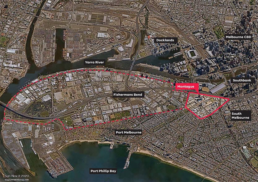
On November 1, the state government finally released eagerly awaited implementation and development contributions plans for the 43-hectare precinct, marking a significant milestone in the future renewal of Fishermans Bend, which is forecast to accommodate 80,000 residents and 80,000 jobs by 2050.
The precinct plans are now open for public consultation and workshop participation until February 23, and will serve as a road map for the transformation of Montague, with details on how the area will adapt, transition, and change towards its 2050 vision over the next 10 years.
Fishermans Bend is Australia’s largest-ever urban renewal project and is locally governed by the City of Melbourne (north of the Westgate Freeway) and the City of Port Phillip to the south.
Along with Montague, the area is made up of five precincts including Sandridge, Wirraway, Lorimer and the Employment Precinct, with the latter two situated with the City of Melbourne’s municipal boundaries.
But Montague, which is serviced by the existing 109 and 96 tram routes, has been developing at a much faster pace than its neighbouring precincts and is already largely complete with the new South Melbourne Primary School and adjoining Kirrip Park.

Among the key ideas for Montague, which is expected to house up to 23,000 residents, is the creation of new linear parks along Buckhurst, Johnson, Woodgate and Ferrars streets, while the “Montague North open space” could see a significant new reserve established on what is currently a car park at the corner of Munro and Montague streets.
Johnson St, between Munro St and Normanby Rd, will also be closed to make way for a new park, with other locations at Whiteman, Thistlethwaite, Gladstone and Woodgate streets also mooted for pocket parks.
The government will also investigate appropriate sites for a new sports and recreation hub in Montague North to form part of the district facility near North Port Oval, as well as an “arts and cultural” hub in the area between Buckhurst and Gladstone streets, west of Montague St.
The route 109 tram stop would also be upgraded in 2028 under the plans, which also flag “strategic cycling corridors” for Montague and Buckhurst streets. A range of safety upgrades and traffic treatments will also be investigated across the precinct, including an upgrade for the busy Montague and Buckhurst streets intersection.
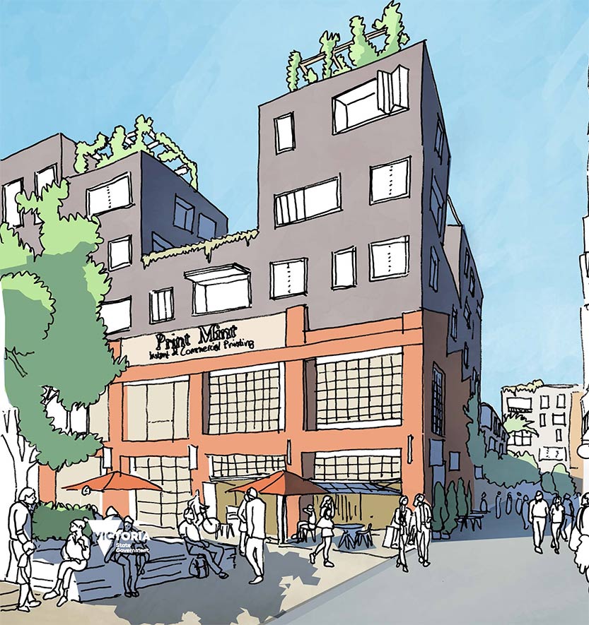
One of the “key moves” in the plans would see a swathe of new laneways created right across the area, predicting that Montague will be “famous for its network of destination laneways” by 2050.
Already looking ahead at ways to preserve, reimagine and extend these future laneways, the plans also moot a new trail linking Fennell Reserve to City Rd with an “immersive and meandering walking experience through Montague’s storied southern neighbourhood”.

Another highlight includes a proposed “Montague Walk”, “stitching together” Montague’s southern and northern neighbourhoods across the light rail stop from the precinct’s new civic centre at Buckhurst St, which will be transformed into a “vibrant main street”.
Fishermans Bend Development Board chair Meredith Sussex said the staged plans would deliver $2.6 billion worth of essential local infrastructure in the urban renewal area.
“After an unbelievable amount of work by an unbelievable number of people, and COVID, the draft Fishermans Bend Development Contributions Plan has been released for public comment,” Ms Sussex said.
“The plan contains a number of innovative approaches to urban planning. Also released is the draft Montague Precinct Implementation Plan which has been developed as interest in Montague as a place to live and work is growing rapidly.”
We are looking forward to the public feedback on both plans.
Following public consultation, which closes February 23, an amendment to the Port Phillip Planning Scheme will be made to implement changes to the Fishermans Bend planning framework in the coming decade to help “transition the precinct towards its potential”.
However, with the implementation plan released after the planning framework was finalised by the state government in 2018, the delays have been criticised by residents and key stakeholders who argue it has meant planning was now occurring concurrently with booming private development in the precinct.
Resident Helen Robertson said her greatest concern was that the plans had no “additional infrastructure being implemented to support the residents” amid current rapid construction.
“I have complained to the council about the pile driving in Normanby Rd, which is causing cracks in our property, but nobody responds to our request for an engineering report to be done to identify potential instabilities in the land,” she said.
“Construction on both Normanby Rd and Gladstone St will see thousands of additional residents in the area, but no additional car parking or public transport exists. The rubbish that the construction sites and workers create goes unchecked, so we live in a garbage dump.”
Ms Robertson said this was on top of multiple robberies occurring in the area, with residents calling for additional lighting and CCTV cameras to be installed “but these requests have also had no positive feedback”.

Cr Marcus Pearl. Photo: Hanna Komissarova.
City of Port Phillip Gateway Ward councillor Marcus Pearl shared the community’s anxiousness, saying the Montague Precinct Implementation Plan “has languished in bureaucratic limbo for over three years” and made “no explicit commitments addressing transportation or alleviating traffic congestion”.
“During this period, several major developments have either been completed or are currently under construction without a comprehensive plan in place to guide them,” Cr Pearl said.
“The current situation necessitates a hurried effort by the government and the Fishermans Bend taskforce to catch up, at a time when our state critically requires additional housing.”
Among the pressing issues with the plan are the absence of a clear governance framework for the area, an ambiguous model of how developer contributions will be invested, and a lack of a transparent funding model for the future.
Among the latest developments soon to begin construction is “The Canopy” at 272-280 Normanby Rd, with developer Gamuda Land given approval to build a 20-storey building featuring retail shops, offices and 213 dwellings, including 12 apartments as affordable housing, as well as the 3000-square metre public park on Johnson St.
Anthropologist Dr Heather Threadgold, a consultant at Aboriginal urban design firm Murri: Yul, who has worked with Gamuda Land to create the public park, said it was a “great community-based project” with the opportunity to restore the natural landscape while incorporating Aboriginal and historic perspectives to pay homage to the site’s historical and environmental significance and layering.
Heart Gardening Project community group head Emma Cutting is also involved in the project, saying it is “very important that developers take intentional and consistent actions to increase and strengthen our communities, not just of humans but of flora, fauna and fungi”.
“It is exciting that Gamuda Land is keen to turn the park alongside The Canopy into a part of the Melbourne Pollinator Corridor and The Heart Gardening Project and Gamuda have worked together positively in a few ways during the initial stages of design,” she said.
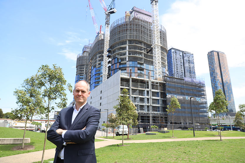
In other projects, a 40-level mixed-use tower is proposed to house 406 apartments at 249-251 Normanby Rd, which is currently under assessment by the state government, while construction is well under way for three mixed use towers of 26, 26 and 28 levels at 15-85 Gladstone St, South Melbourne by American-based developer Greystar (pictured below).

Four mixed-use towers of 27, 29, 30 and 30 levels are also approved for 6-70 Buckhurst St, which will house 1004 apartments, as well as offices and retail shops, and 697 car spaces.
RMIT’s professor of urban planning and sustainability Sarah Bekessy told Southbank News massive high-rises were not the way forward towards sustainable high-density urban cities such as Montague.
“Fishermans Bend is a hugely important opportunity for Melbourne,” she said, but noted it had a “chequered history with the kind of unfortunate planning decisions that have hamstrung some of the innovation that is potential for the site”.
“The evidence is that if you’re going to plan really high-density environments for families, you’re better off keeping it to the mid-rise, six-storey level, and it can still be close to the street.”
“I think we need to be thinking about nature as a key part of the solution to some of the problems that Fishermans Bend is going to face in terms of cooling, reducing wind speed, creating a sense of place, and generating enchantment in a place, otherwise it’s going to be an urban jungle.” •

Sally Capp: one last chat as Lord Mayor of Melbourne


 Download the Latest Edition